Risk and Results in Belize
- Date: 19 November 2014
- Author: Katie Arkema and Amy Rosenthal
What do looking both ways to cross the street, buying insurance, and marine conservation have in common? Answer: They are all strategies for reducing risks. And we do such things because they help to achieve better results — crossing safely, avoiding bankruptcy, and preserving the coastal habitats that manatees, turtles, and people all depend on.
Working with researchers and planners from WWF, Stanford University, and the Belizean government, we developed a new method to assess risk to coastal and marine habitats. Our habitat risk assessment (HRA) model produces maps that show where damage to ecosystems like coral reefs and mangroves is most likely to occur now and under any number of future scenarios.
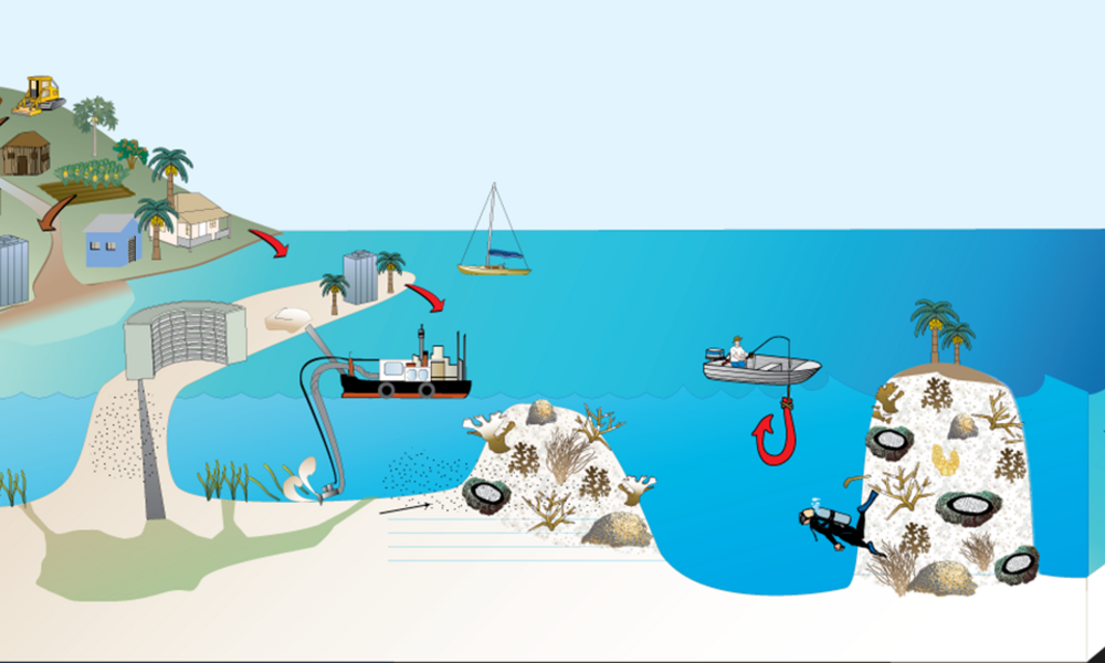
Coastal and marine ecosystems in Belize are at risk of degradation from many ocean activities, including marine shipping and dredging. (© Healthy Reefs International)
Coastal planners can use this information to prioritize habitats for conservation action and to identify where to relocate certain activities that can have negative impacts on habitats we care about. By moving activities to areas without sensitive ecosystems or reducing their intensity, coastal planners can significantly reduce risks to habitats without compromising economic development.
Just like deciding when to cross the street, assessing risk to habitats requires two kinds of information: exposure and consequence. Exposure is the distance between you and an oncoming car as each second passes. Consequence is what would happen if you got hit by that car. Similarly, habitats exposed to a risk or stressor experience the same stress differently. The HRA model combines information about exposure and consequence to identify which habitats are at the greatest risk where, and whether reducing exposure to a particularly damaging activity is a viable management strategy. Using this red-yellow-blue risk-management system, coastal planners can then limit damaging activities near coastal habitats, establish conservation-compatible activities near the most vulnerable habitats, and expand economic and development activities in areas where risks are low.
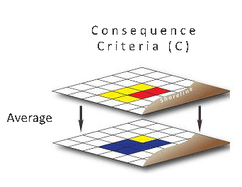
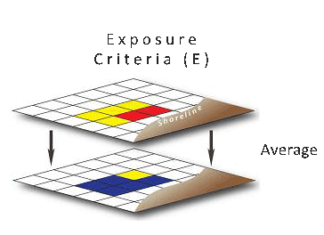
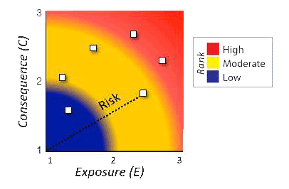

Output map of risk to a habitat from a single human activity
The results of our HRA study, published today in Environmental Research Letters, were used to establish guidelines for Belize's first national coastal zone management plan. The plan reduces the area of habitat at high risk by 20%, while also expanding economic opportunities — tripling the area for coastal development and tourism infrastructure, doubling that for marine aquaculture, and holding steady the area for lobster fishing. This example shows that in places like Belize we can both reduce risks to habitats and the species we care about and provide opportunities for smart economic development.
The open source HRA software is now online and freely available as part of the Natural Capital Project's InVEST toolkit. You can also explore maps of the risk results, habitats and activities.