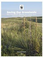
• Saving Our Grasslands: Summary of Recommendations Brochure
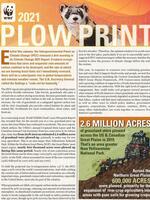
  • 2022 Plowprint Report Brochure

    2022 Plowprint Report (, )

    October 25, 2022

    In its seventh year, WWF’s Plowprint Report analyzes the rate of grasslands plow-up across the US, Canadian, and Mexican portions of the Great Plains. This analysis is based on the USDA’s annual Cropland Data Layer, the Agriculture and Agri-Food Canada’s Annual Crop Inventory, and Sentinel-2 satellite data classified using Google Earth’s Engine for Mexico from two years prior to the release date. 

    more info
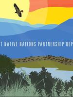
  • 2021 Native Nations Partnership Report Brochure

    2021 Native Nations Partnership Report (, )

    October 11, 2021

    WWF’s inaugural Native Nations Partnership Report presents a summary of WWF's collaborative projects with Native nations over the past several years.

    more info
  • 2021 Plowprint Report Brochure
  • Plowprint Report: Frequently Asked Questions Brochure

    Plowprint Report: Frequently Asked Questions (application/pdf, 156 KB)

    December 13, 2016

    Answers to important questions in regard to the 2016 Plowprint Report ,such as: What is the methodology behind the report? Why was it developed? And, What is WWF doing to slow grassland loss?

    more info
  • Plowprint Technical Report Brochure

    Plowprint Technical Report (application/pdf, 2.53 MB)

    September 20, 2016

    The Plowprint Report, which includes both a general information and technical version, has been developed to broaden public awareness of grasslands loss, and to offer a consistent way for the conservation community to track year-to-year grassland conversion to cropland across the focal regions of the Mississippi River Basin and Great Plains. This is the first edition of the full technical report, which will be released on an annual basis.

    more info
  • Plowprint General Report Brochure

    Plowprint General Report (application/pdf, 3.82 MB)

    September 20, 2016

    The Plowprint Report, which includes both a general information and technical version, has been developed to broaden public awareness of grasslands loss, and to offer a consistent way for the conservation community to track year-to-year grassland conversion to cropland across the focal regions of the Mississippi River Basin and Great Plains. This is the first edition of the report, which will be released on an annual basis.

    more info